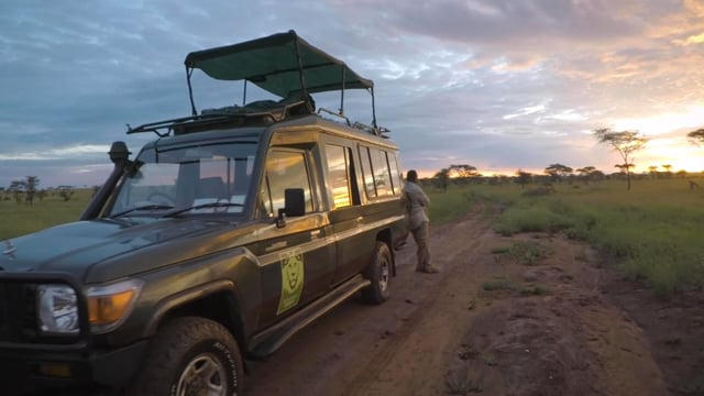
On our April Safari with ADS, we created an interactive map of our travels. You can see it here: http://www.africadreamsafaris.com/misc/BeckSafariMap.html
This is an interactive map. You can zoom in and out, clicking on the dates in the box at the upper right will turn that day’s track on and off. To see where you went on a particular day, you would click on each day to turn them all off, then turn on the day to inspect individually.
We were asked “How did you do that?”. It is really quite simple. In addition to creating a map, you have the data you need to “geotag” your photos. More about that later.
To create a map, all that is necessary is that each day you make a GPS “tracklog”. There are unfortunately hundreds of ways to create a tracklog. I say “unfortunately”, because some research will likely be involved on your part to find a device suitable for your needs and price range. I talk more about devices later.
A tracklog file consists of a list of GPS coordinates with a timestamp. My tracking device was set to record my location once every 30 seconds. I turn it on in the morning when we got up and turned it off when we got back to our lodging in the late afternoon, and then charged it. In my case, I also downloaded the days tracklog to my laptop for backup, but my unit can hold several weeks of data so a laptop on your safari is not necessary.
When our safari ended, I had a set of tracklog files, one for each day. I gave them names like “Africa Day 1 Track Log”. I don’t need the date in the name as the time info is contained in the tracklog data, and it makes naming easier for me. But you can give these files whatever name you want. In my case, I saved my data as .gpx files. Like devices, there are dozens if not hundreds of GPS file formats. .gpx is fairly common. There is free software called “gpsbabel” that can convert from most formats to .gpx. This is available for Apple Mac OS as well as Windows. My device can save as .gpx, so I didn’t need to use GPSBABEL, but depending on how you create your tracklogs, you may need to convert your data to a different format.
I put all my tracklogs into a new directory, then created a zip archive of the directory. This will create a single file with a .zip file extension. This makes it easy to upload the data to create your map.
In a browser window, go to the website gpsvizualizer.com. Your window will look something like this:

In the green box where it says “Get Started Now!”, click the “Choose File” box, then upload your .zip file with all your tracklogs in it, click on “Go!”, and you have your map! It’s that simple. You can do a lot of customization if you would like. To customize, in the dark green box at the top of the window under “Make a Map” click on “Google Maps”. You get a window that lets you input your file as well as make a lot of different choices of map size, track colors, tick marks, and more. My map is just the default map with no customzations. GPS Visulaizer is donation ware. Consider making a donation for the great work the programmers did to make this so easy.
Here is how my map looks after making it:

Note the text above the map. There is a link to download the map (this will be a .html file) and what to do if you want to display the map on a website. I just downloaded my map and keep that with our safari photos.
That’s it! That’s how to create a map of your safari.
Geotagging Photos
With a tracklog, you have all the data you need to geotag your photos. Why would you want to geotag your photos? You may not want to. For me, we travel a lot, and sometimes I forget where I took a particular photo. Geotagging a photo is merely adding GPS coordinates to the EXIF information that is embedded in the photo. This EXIF data contains such things as time the photo was taken, camera model, aperture, shutter speed, ISO, and lots more. It also has fields for GPS coordinates. Many photo apps can display on a map where the photo was taken. I’m not going to describe in detail how to geotag your photos, there are many dozens of programs and apps that will do this for you. If you are interested in pursuing further, just Google “How to geotag photos” and you can learn how. I use Adobe Lightroom and Jeffrey Friedl’s wonderful GPS plugin.
GPS Tracklog Devices
There are myriad devices you can use to create tracklogs. The cheapest way is to use your smartphone and a free app. Visit your app store for your phone and search for “GPS logger”. You’ll find dozens of apps, some free, some with in-app purchases, that will create .gpx tracklogs. But the phone app may not be the best way. First, the phone GPS may not be all that accurate, and it probably may need to be connected to the cellular network to get your location, depending on your phone. When I travel, I often keep my phone off the cellular network in order to not rack up huge cellular bills. Plus, not everywhere I travel will my phone work. The middle of the Serengeti being one of those places. I elected not to go this route. However, newer smart phones have better GPS capabilities. For iPhone, there’s an app called GPS Kit Pro that others have used and report great results. This app is not free, its about $20, it supports an offline mode so you don’t have to be connected to the cellular network. This would definitely be something to check out to get basic capability.
The next kind of device is a GPS data logger. These come in many many forms. The most popular would be a GPS computer for a bicycle or running/fitness. These all create tracklogs, logging location, time, as well as other information such as speed, cadence, atmospheric pressure (for computing grade for a bike), and more. These can create .gpx files, if not from the vendor’s software, then using something like GPSBabel. I didn’t use my bike computer to create my tracklogs for a couple of reasons. First is battery life. I didn’t believe my bike computer battery would work for over 12 hours continuously. It might, but it would be near it’s design limits. Secondly, a bike or fitness GPS will take data points very frequently, multiple samples per second. That will use more power and fill up it’s memory. Generally, their sample rates are not user programmable. So if a bike computer takes a data point every 1/2 second and you only really need a data point every 30 seconds or every minute, then the memory is using 100x more storage than necessary. It may not hold more than 10-12 hours of data. You would have to download these devices daily. But if you are only going to do this one time or infrequently and already own a bike/fitness computer, then this may well work for you. Experiment with it before your safari to see if it has enough battery life and see how many days of data it will store.
The device I used is a stand alone GPS data logger. It has one button which is a power on/off button. It also has an LED that flashes every couple of seconds when GPS satellites are synced. It cost about $50. It holds many weeks worth of tracklogs. It has a USB connection to download the files to a Windows or Mac computer using the vendors software (which has a poor user interface, but it works). My device is small, battery lasts over 24 hours on a charge, and is not too picky about where it’s located. I clipped it to my backpack and left it on a seat on our safari. It works equally well with a lanyard around my neck and tucked under my clothing, or in a pocket. It is a USGlobalSat DG-200 datalogger. I purchased it on Amazon, but it’s no longer available there. I think one would be hard to find. http://www.amazon.com/gp/product/B005QXYE5S/ref=oh_aui_search_detailpage?ie=UTF8&psc=1
I’ve scanned some websites and chat boards and found a few inexpensive devices others have used for similar purposes. All links are to Amazon product pages. I have not reviewed their specs or operation in detail, these are suggestions to get you started. You can also search on Amazon for “GPS data logger” and see hundreds of options.
$55 G-PORTER GP-102+ Multifunction GPS Device/ Data Logger
$40 Canmore GT-730FL USB GPS Receiver Tracker Data Logger
$110 Qstarz BT-Q1000XT Bluetooth Data Logger GPS Receiver
$75 Holux RCV-3000 Bluetooth Data Logger USB GPS
$60 i-gotU GT-120 USB GPS Travel Logger
$90 Qstarz BT-Q818XT 10Hz 66 Channel Bluetooth GPS Receiver
There are way more sophisticated GPS devices that can do more than create tracklogs. They can hold maps, help you navigate while hiking, geocaching, etc. They also cost more. Here are a few to look at:
$155 Bad Elf 220 GPS Pro
$60-$400 Magellan Explorist Many models
$94-$400 Garmin GPS products Many different models
Hoepfully, this will get you started mapping your journeys and geotagging your photographs!
Feel free to leave comments with additional suggestions or ask questions below.
Gary B.
Santa Cruz, California
Safari Dates: April 8, 2015 to April 20, 2015


Follow Us